Image via Robert Simmon/Earth Observatory
On June 30, air temperatures in Death Valley National Park in California peaked at a skin-scorching 129° Fahrenheit. That unofficially matched the US record for June, set back in 1902 in the appropriately-named Volcano, California. (For a cool explainer on how records are set, see the Washington Post.)
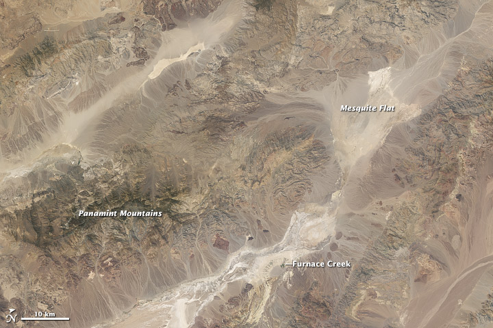
The above photo shows ground surface temperatures as they peaked on June 30, and is courtesy NASA's Earth Observatory, which used the thermal infrared sensor on NASA's Landsat 8 satellite to image the desert. (Here's the giganto size version.) Compare the false-color image above to a regular satellite image below, and you get some cool takeaways as to how a desert heats up.
Higher altitudes are cooler, as exemplified by the Panamint Mountains. Looking at the flatlands around Furnace Creek, the (slightly) cooler areas appear to have more vegetation, while the hottest areas are bare, heat-absorbing earth.
The Earth Observatory explains that Death Valley is so hot largely because it's a valley. Because it's stuck between a pair of mountain ranges, it gets little rain, which leaves it with little vegetation. Instead, the bare earth absorbs the pounding Sun's heat all day long. While that heat is released at night, it remains trapped in the valley. When it cools and sinks, it causes turbulent, hot winds that keep the valley dry. Who's up for a visit?